The UK weather forecast is looking set to be dominated by very wet conditions for the next seven days.
Reports suggest Britain will be rocked by heavy rain and thunderstorms across the country.
Some areas might even be hit by flooding, meaning May will continue to be a very damp month.

How the week’s weather will begin
Despite predictions of a ‘mini heatwave’ for the past weekend in the south of England, most of the country endured drizzly, grey conditions.
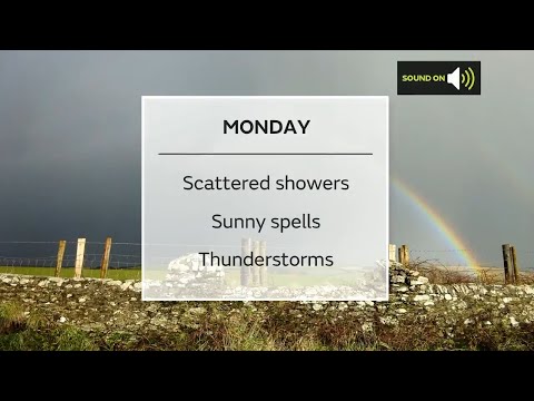
However, Monday should see a little sunshine alongside the prevailing showers.
Read more: GMB: Alastair Campbell gets a mixed reaction from viewers
The BBC reports this afternoon will continue to be mostly mild. But showers could become heavier in the north and west, with potential for hail.
Tonight, however, it is expected to become drier with winds also easing.
How the weather will develop later in the week
Those drier conditions will not endure, however. The Met Office’s weather outlook until Wednesday notes it will become more “unsettled” and “more prolonged periods of rain” are likely.
The Met Office forecasts: “Some heavy bursts likely at times with a risk of thunderstorms.”
But on the upside, it seems it may feel less bitter during the downpours as morning frost becomes less regular.

What the Met Office says
The Met Office’s long range forecast from May 13 to May 22 predicts: “Cloudy on Thursday starting with outbreaks of rain and showers, especially in the southwest of the UK.
“Showers are expected to become more widespread during the day, with these heavy and potentially thundery for the south. The breeziest conditions expected in the far northwest.
“Remaining showery for the rest of the week with the chance of a brief settled spell from the west into Friday.
Read more: The Pursuit of Love disappoints BBC viewers as they ‘miss’ Line of Duty
“The unsettled theme then continues through the remainder of this period, with longer spells of rain and showers in between, the clearest conditions are most likely in the north.
“It’s likely to be breezy at times; especially around coastal areas, where gales may occur. Temperatures will be near to or slightly below average, though with the formation of overnight frosts becoming unlikely.”

Despite yesterday being the warmest day since the end of March – and it having been the coldest April for decades – there will be no getting used to cosy temperatures as yet.
Some areas in the south of England enjoyed temperatures approaching 20C. But that is unlikely to be experienced again for a while.
Reports suggest it is doubtful that temperatures will reach 10C, especially in the north of England, even though frost is less likely going forward.
Indeed, some regions could even experience chilly lows of around 5C. So it looks like most of us could be wrapping up and getting our brollies out for the foreseeable.
Leave us a comment on our Facebook page @EntertainmentDailyFix and let us know what you think of this story.


